Posted on

Day 6: From Fort Augustus to Inverness—Across the Legendary Loch Ness

After successfully navigating the five locks at Fort Augustus, we were ready for one of the most anticipated stages of our Caledonian Canal adventure.

Today’s journey would take us across Loch Ness, through Loch Dochfour and along the final canal section into Inverness. It was the last major stage of our voyage—and a spectacular way to complete our journey through the Great Glen.

Leaving Fort Augustus

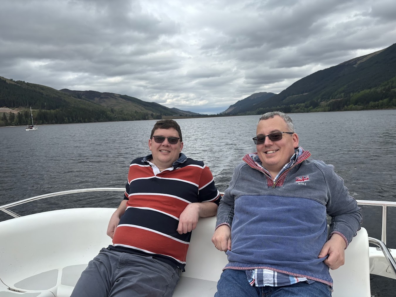
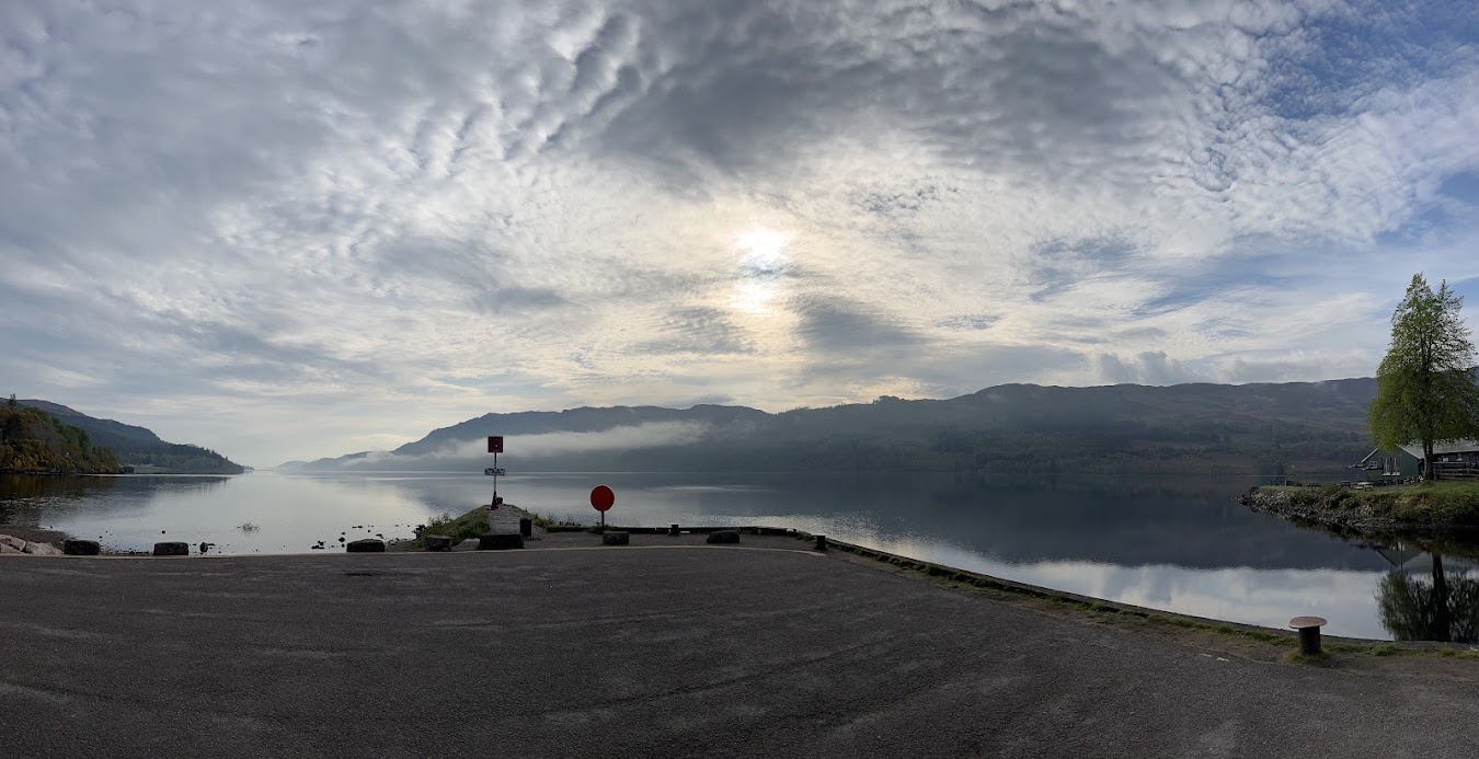
We departed Fort Augustus in the morning and headed onto the vast waters of Loch Ness.

Behind us were the lock flight and the welcoming village where we had spent the previous evening. Ahead stretched one of the world’s most famous and mysterious bodies of water.

The transition from the sheltered canal to the open loch was dramatic. Our boat suddenly felt very small against the immense expanse of dark water and the steep Highland slopes rising on either side.

Cruising across Loch Ness

Loch Ness extends for approximately 23 miles through the Great Glen and reaches depths of more than 220 metres.

Its dark, peat-stained waters contain more freshwater than all the lakes in England and Wales combined. That extraordinary scale became increasingly apparent as we travelled north-east towards Inverness.

The surrounding landscape was breathtaking. Wooded slopes descended towards the shoreline, while distant hills disappeared into the mist. The weather and light continually changed the character of the loch, revealing new views as we cruised.

After several days on narrower canal sections, the openness of Loch Ness felt exhilarating.

Searching for Nessie

No journey across Loch Ness would be complete without keeping watch for its most celebrated resident.

Stories of mysterious creatures in these waters extend back centuries, although the modern legend of the Loch Ness Monster developed principally during the twentieth century. Numerous sightings, photographs and investigations have followed, but Nessie has remained stubbornly elusive.

We watched the water carefully for unexplained ripples, suspicious shadows or the sudden appearance of a long neck.

Unfortunately, nothing emerged to welcome us.

Perhaps Nessie was enjoying a day off—or had seen our boat handling and decided to keep a safe distance.

Whatever the truth behind the legend, it added an irresistible sense of intrigue to the journey. The depth, darkness and sheer scale of the loch make it easy to imagine that something unexpected might be concealed beneath its surface.

Through Loch Dochfour

At the northern end of Loch Ness, we entered the smaller and more sheltered Loch Dochfour.

The atmosphere changed almost immediately. After the vast openness of Loch Ness, Loch Dochfour felt intimate and peaceful, enclosed by wooded banks and lush Highland scenery.

The calmer water offered an opportunity to slow down and reflect upon the distance we had travelled.

During the previous few days, we had crossed Loch Lochy, explored Fort William and Glenfinnan, worked our way through the Fort Augustus locks and navigated the legendary waters of Loch Ness.

Our journey through the Great Glen was approaching its conclusion.

The final canal stretch

Beyond Loch Dochfour, we re-entered the constructed section of the Caledonian Canal for the final approach to Inverness.

The canal carried us through a gentler landscape of trees, meadows and quiet water. Compared with the scale and drama of Loch Ness, this final section felt wonderfully serene.

There was time to absorb the surroundings and enjoy the distinctive rhythm of canal travel once more.

Reaching Inverness was exciting, but also bittersweet. Each mile brought us closer to our destination and the end of an adventure that had already provided so many memorable experiences.

Arriving in Inverness

By the afternoon, signs of Inverness gradually began to appear.

After days surrounded by lochs, mountains and remote Highland scenery, the return to a city felt striking. Buildings replaced wooded hillsides, and the tranquillity of the waterway gave way to the energy of the Highland capital.

Inverness occupies an important position at the northern end of the Great Glen, where the River Ness flows from Loch Ness towards the Moray Firth. Its strategic location has shaped the city’s history for centuries.

Reaching it by boat gave us an enormous sense of achievement.

We had travelled through the heart of the Highlands, following a remarkable route of natural lochs and engineered waterways from Laggan to Inverness.

Exploring the Highland capital

Once the boat was safely moored, we stepped ashore to explore.

Inverness is often described as the Gateway to the Highlands, combining the character of a historic Scottish city with a lively modern centre.

We wandered through its streets and followed the River Ness, enjoying the contrast between the city and the remote landscapes through which we had recently travelled.

Inverness Castle occupies a commanding position above the river and has long been one of the city’s most recognisable landmarks. The surrounding area offered attractive views across the city and the countryside beyond.

We also had an opportunity to learn more about the region’s past. Inverness and the surrounding Highlands have been shaped by Pictish settlement, medieval conflict, clan history and the Jacobite uprisings.

The city felt like an appropriate destination for a journey that had combined spectacular scenery with Scotland’s rich history.

Celebrating our arrival

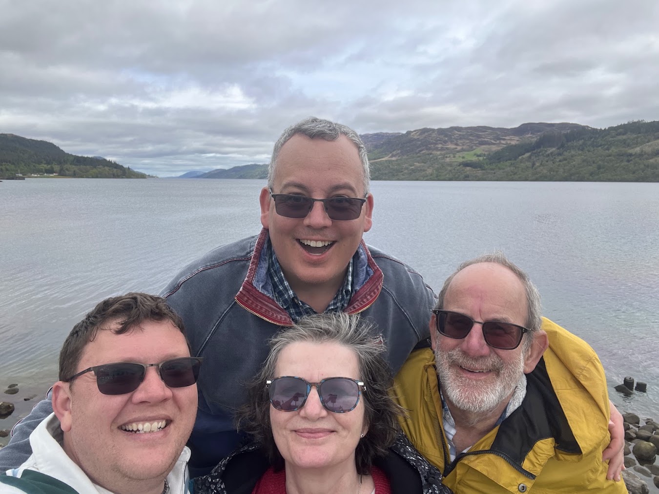
That evening, we found a cosy local pub where Chris, Neil, Naomi and I could celebrate completing our voyage to Inverness.

Over dinner and drinks, we reflected upon everything the journey had involved: unfamiliar boats, immense lochs, changing weather, energetic lock flights and numerous memorable excursions ashore.

Each day had revealed another aspect of the Highlands.

Reaching Inverness marked the completion of our outward journey, but the experiences shared along the way mattered far more than the destination itself.

Through the heart of the Highlands

Today brought together everything that made the Caledonian Canal such an extraordinary adventure.

We crossed the legendary waters of Loch Ness, passed through the peaceful surroundings of Loch Dochfour and followed the final canal stretch into the Highland capital.

The journey provided a unique perspective on the Great Glen—one that could only truly be appreciated from the water.

Tomorrow, we would spend more time discovering Inverness. For tonight, however, we were content to celebrate our arrival and remember an unforgettable voyage through the heart of the Scottish Highlands.
Posted on

Day 5: From Laggan to Fort Augustus—Five Locks and the Gateway to Loch Ness

After yesterday’s rainy excursion to Glenfinnan, we returned to the water for another memorable stage of our Caledonian Canal adventure.

Today’s journey took us from Laggan to Fort Augustus, where we faced one of the canal’s most distinctive challenges: guiding our boat through the impressive flight of five locks leading towards Loch Ness.

It was a day of beautiful Highland scenery, physical effort and genuine teamwork.

Leaving Laggan

We departed Laggan in the morning, with mist still clinging to the surrounding hills.

The water was calm and the landscape wonderfully peaceful as we continued along the Great Glen. After several days exploring the Highlands, we were becoming accustomed to the slower rhythm of life aboard—but today promised something rather more energetic.

Ahead of us lay Fort Augustus and its famous staircase of five locks.

Approaching Fort Augustus

Fort Augustus sits at the southern end of Loch Ness, where the Caledonian Canal passes directly through the centre of the village.

Its flight of five locks is one of the canal’s most recognisable features. Arranged in a continuous staircase, the locks allow boats to overcome the difference in water level between the canal and Loch Ness.

They also create quite a spectacle. The locks run through the heart of the village, surrounded by historic buildings, pubs, shops and curious spectators watching boats make their slow progress.

As we approached, our anticipation grew. This would be very different from passing through a single lock on a quiet stretch of canal.

Entering the lock flight

Navigating the Fort Augustus flight required patience, concentration and close co-operation.

Rather than using the engine to move between the chambers, we guided the boat through using ropes. Members of our crew remained on the lockside, carefully pulling the boat forward as each chamber became ready.

With the water levels changing around us, the ropes needed constant attention. They had to remain controlled without becoming too tight, while the boat needed to be kept safely away from the lock walls and gates.

Every movement had to be deliberate.

Pulling the boat through

Moving through five consecutive locks made the process physically demanding.

As one chamber completed its cycle, we guided the boat forward into the next, secured the ropes and began the process again. There was little opportunity to relax before preparing for the following lock.

Chris, Neil, Naomi and I each had a role to play. Clear communication became essential as we coordinated the ropes, watched the boat’s position and responded to the changing water levels.

It was tiring work, but there was also something deeply satisfying about it.

Moving the boat by hand created a direct connection with the canal. We could feel its considerable weight through the ropes and appreciate the controlled power of the water raising or lowering it within each chamber.

Following generations of boaters

The Fort Augustus locks form part of the remarkable waterway designed under the direction of Thomas Telford during the early nineteenth century.

The Caledonian Canal was created to provide a navigable route through the Great Glen, linking Scotland’s east and west coasts while avoiding the hazardous journey around the north of the country.

Passing through the locks made that history feel tangible.

For more than two centuries, boats and crews have travelled through this same flight. The vessels, ropes and operating systems may have changed, but the essential process remains recognisable: controlling water, overcoming height and moving carefully from one chamber to the next.

By the time we reached the final lock, our arms were tired—but the sense of achievement was considerable.

Loch Ness revealed

Emerging from the lock flight brought us to one of the most anticipated moments of our holiday.

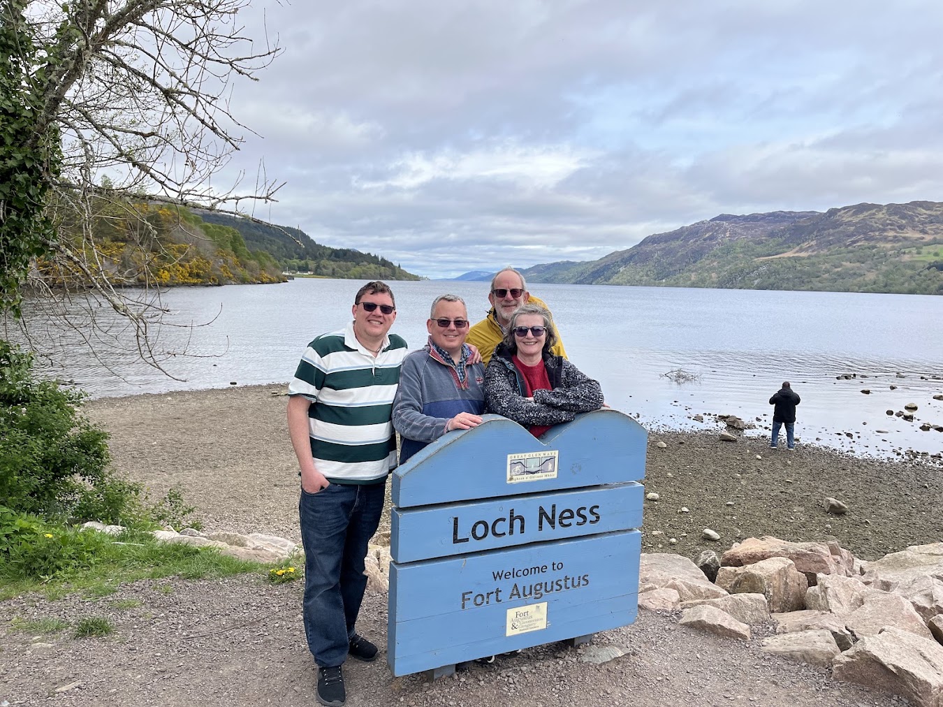
Ahead of us lay Loch Ness.

The scale of the loch was immediately striking. Its dark waters stretched into the distance between steep Highland slopes, creating an atmosphere that felt both dramatic and mysterious.

Loch Ness is the largest body of freshwater in Great Britain by volume and the most famous part of the Caledonian Canal. Its extraordinary depth and dark, peat-stained water have helped sustain stories of a mysterious creature inhabiting the loch.

Standing at its southern entrance, it was easy to understand how such legends had developed.

The water seemed vast, brooding and full of possibilities.

Mooring at Fort Augustus

After completing the lock flight, we moored at Fort Augustus for the evening.

The village occupies an exceptional position between the canal and Loch Ness. Boats pass directly through its centre, making the waterway an inseparable part of village life.

After the physical effort of the locks, we were ready to step ashore, explore and find somewhere welcoming for dinner.

A local pub provided exactly what we needed: a well-earned meal, an opportunity to rest and time to reflect upon the day with Neil and Naomi.

Around us, other boaters and visitors shared stories of their journeys. That friendly atmosphere added to the sense that we had reached an important staging point on our adventure.

A day of teamwork and achievement

Today was about much more than travelling from Laggan to Fort Augustus.

Guiding our boat through five consecutive locks tested our communication, patience and ability to work together. It was tiring, occasionally tense and immensely rewarding.

By the end, we had not only reached the gateway to Loch Ness but also experienced one of the defining features of the Caledonian Canal.

Tomorrow, we would leave the relative shelter of the canal and begin exploring the legendary waters of Loch Ness.

For tonight, however, we were content to remain in Fort Augustus, enjoy our achievement and rest some very tired arms.

Posted on

Day 4: A Rainy Afternoon at Glenfinnan Viaduct

After returning to the Le Boat base at Laggan, we found ourselves with a few free hours and no immediate plans.

The rain made an afternoon aboard considerably less appealing, but having the car nearby gave us another option. We decided to leave the canal temporarily and drive to one of the Highlands’ most recognisable landmarks: Glenfinnan Viaduct.

It proved that even the wettest afternoon could become a memorable part of our Scottish adventure.

A journey through the rain

The drive from Laggan to Glenfinnan carried us through more spectacular Highland scenery.

Low clouds clung to the hills, rain swept across the landscape and distant mountains disappeared into the mist. It was not the bright Scottish panorama often seen on postcards, but the weather gave everything a wonderfully dramatic atmosphere.

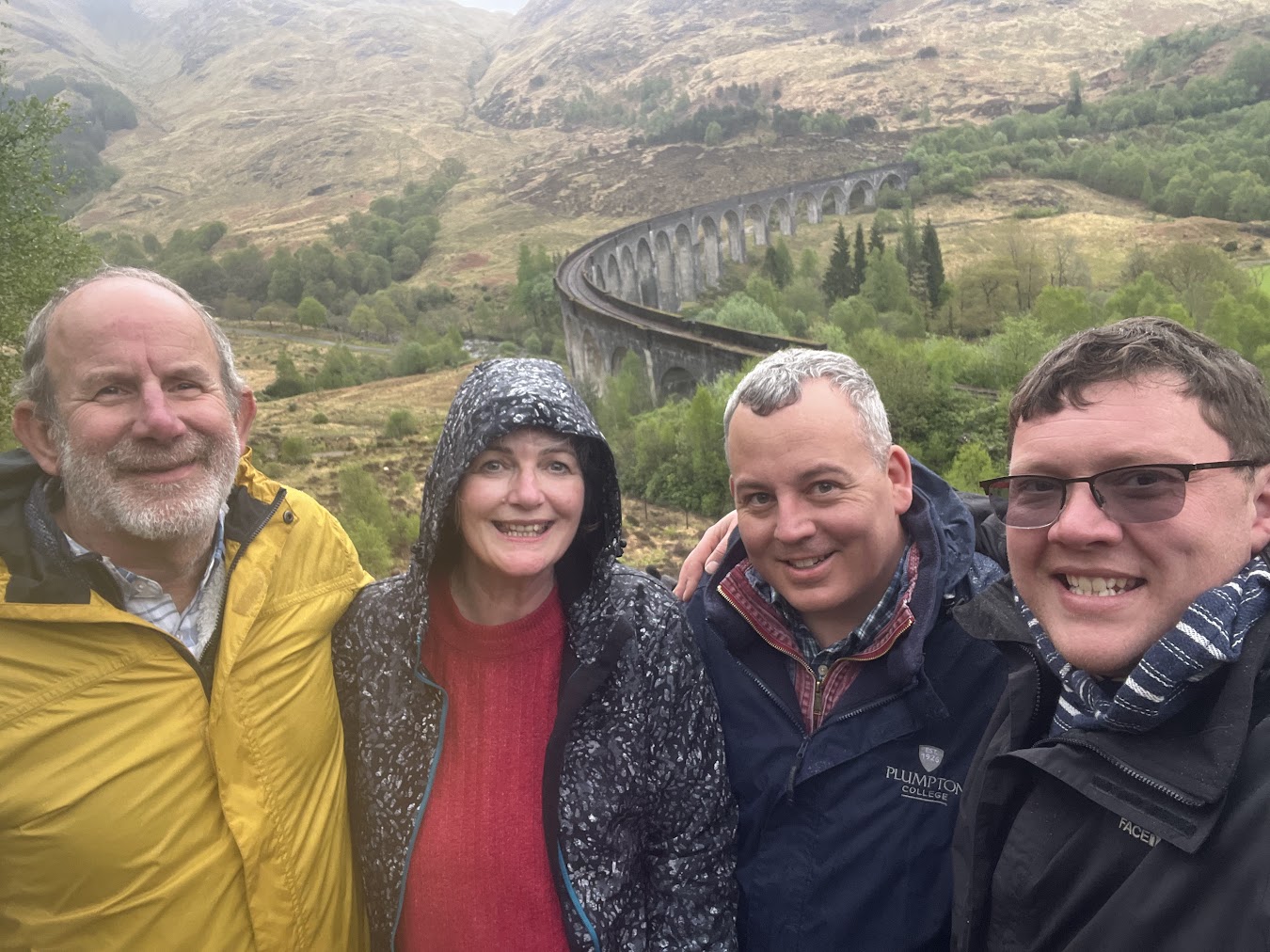
As we approached Glenfinnan, the famous viaduct emerged against the rugged landscape. Its sweeping curve and enormous concrete arches looked even more impressive beneath the dark sky.

Glenfinnan Viaduct

Completed in 1901, Glenfinnan Viaduct forms part of the West Highland railway line between Fort William and Mallaig.

The structure crosses the valley on 21 arches and was built from mass concrete—an innovative construction method at the time. More than a century later, trains continue to cross it regularly.

The viaduct is now internationally famous for its appearances in the Harry Potter films, where it carries the Hogwarts Express towards the fictional school.

However, its importance extends far beyond the cinema. The railway helped connect remote Highland communities with the rest of Scotland, supporting travel, trade and the development of the region.

Seen in person, the viaduct felt less like a film location and more like an extraordinary piece of engineering shaped to fit the surrounding landscape.

Exploring Glenfinnan

Despite the persistent rain, we spent time exploring the area around the viaduct.

The mist hanging over the hills created a mysterious atmosphere, while the viaduct’s arches appeared and disappeared against the shifting clouds. Although the weather prevented the clear views we might have hoped for, it gave Glenfinnan a character entirely of its own.

We became thoroughly wet, but abandoning the visit would have meant missing one of the most memorable sights of the holiday.

Sometimes Scotland simply requires the correct clothing and a willingness to accept that remaining dry is no longer a realistic objective.

The Glenfinnan Monument

We also visited the nearby Glenfinnan Monument, standing at the head of Loch Shiel.

The monument commemorates the Jacobite Rising of 1745. It was here that Prince Charles Edward Stuart—better known as Bonnie Prince Charlie—raised his standard and gathered supporters at the beginning of his attempt to restore the Stuart monarchy.

The campaign initially achieved several dramatic victories before ending in defeat at the Battle of Culloden in April 1746.

Surrounded by mountains and overlooking Loch Shiel, the monument occupies a striking location. Even through the rain and mist, the landscape helped convey the scale and drama of the history associated with the site.

Returning to Laggan

After absorbing as much history, scenery and rainwater as we reasonably could, we returned to the car and began the journey back to Laggan.

Our visit had been an unplanned detour from the Caledonian Canal, but it added another dimension to the holiday. The waterways, railways and roads of the Highlands all tell parts of the same story: overcoming a vast and challenging landscape to connect communities.

Back aboard the boat, the rain continued to fall. We were grateful for shelter, dry clothes and the opportunity to reflect upon an afternoon well spent.

A memorable rainy-day detour

Glenfinnan showed us that poor weather did not have to mean a wasted day.

Instead of remaining aboard watching the rain, we had visited one of Scotland’s greatest railway structures, explored an important site in Jacobite history and experienced the Highlands at their most atmospheric.

The viaduct may have been familiar from films and photographs, but standing beneath it in the rain made it feel entirely different—larger, more impressive and rooted firmly in the landscape around it.

Tomorrow, we would return to our Caledonian Canal adventure. For now, we were content to settle aboard, listen to the rain and remember an unexpectedly rewarding afternoon at Glenfinnan.

Posted on

Day 3: From Laggan to Fort William via Loch Lochy

After two days travelling north and settling aboard our hire boat, our Caledonian Canal adventure finally began in earnest.

Today’s journey took us from Laggan through Loch Lochy towards Fort William. It was our first opportunity to experience the scale and beauty of the Great Glen from the water—and it did not disappoint.

Leaving Laggan

We set off from Laggan in the morning, excited to begin our first full day of cruising.

The peaceful canal section soon carried us towards Loch Lochy, one of the principal natural lochs incorporated into the Caledonian Canal. After the more familiar confines of England’s narrow canals, emerging onto such an immense stretch of open water felt extraordinary.

Our hire cruiser suddenly seemed very small against the surrounding Highland landscape.

Cruising across Loch Lochy

Loch Lochy provided some of the most beautiful cruising we had experienced.

Forested hillsides descended towards the water, with distant mountain peaks rising beyond them. The calm surface reflected the changing landscape and created an atmosphere that felt wonderfully remote.

Travelling by boat allowed us to appreciate the scenery at exactly the right pace. There was time to notice the changing light, search the shoreline for wildlife and enjoy the sheer scale of our surroundings.

This was very different from cruising aboard Tilly Mint. There were no continuous lines of moored boats or tightly enclosed channels. Instead, we had broad water, expansive views and the dramatic landscape of the Great Glen surrounding us.

Legends beneath the water

Like many Highland lochs, Loch Lochy has its own legends.

Stories tell of a mysterious water creature known as the River Horse, or Each-Uisge, which was said to inhabit the loch. Although considerably less famous than the monster associated with Loch Ness, it adds another layer of mystery to these deep Highland waters.

The loch has also witnessed centuries of clan history, conflict and travel through the Great Glen.

Cruising across it felt like passing through both a natural landscape and a corridor of Scottish history.

Approaching Fort William

After crossing Loch Lochy, we continued towards the outskirts of Fort William.

Ben Nevis dominated the surrounding landscape. Britain’s highest mountain provided a magnificent backdrop as we reached our mooring and secured the boat.

The location gave us the best of both worlds: a peaceful place to stay beside the canal and easy access to Fort William by local bus.

With the boat safely moored, we set off to explore the town.

Exploring Fort William

Fort William stands at the foot of Ben Nevis and has long occupied an important strategic position within the Great Glen.

The settlement developed around a military fort established during the seventeenth century and later named after King William III. It subsequently became closely associated with attempts to control the Highland clans and suppress the Jacobite cause.

Little remains of the original fort today, but the town has developed into an important Highland centre and a popular base for walking, climbing and exploring the surrounding landscape.

After experiencing the region from the water, it was interesting to spend time exploring it on foot.

Discovering Highland history

A visit to the West Highland Museum helped bring the area’s past to life.

Its collections explore the history and culture of the West Highlands, including the Jacobite uprisings, traditional Highland life and the development of the town.

The museum provided valuable context for the landscape through which we were travelling. The Caledonian Canal may be an impressive feat of nineteenth-century engineering, but it passes through a region shaped by a much longer and often turbulent history.

Learning more about that history made our journey through the Great Glen feel even more meaningful.

A taste of Scotland

After exploring the town, we found a welcoming local pub for lunch.

The warmth and bustle inside offered an enjoyable contrast to the open water and quiet Highland scenery of the morning. Traditional Scottish food and locally brewed ale provided exactly the sort of hearty meal we needed after our first day’s cruising.

It was also an opportunity for Chris, Neil, Naomi and me to reflect upon the journey so far.

Only two days earlier, we had been driving north from East Sussex. We were now sitting beneath Ben Nevis, having crossed Loch Lochy aboard our own temporary floating home.

Returning to the canal

Later that afternoon, we caught the bus back to our mooring.

The light had begun to soften across the surrounding hills, giving the landscape a different character from the scenery we had experienced that morning.

Back aboard, we settled down for a quiet evening beside the canal. After the anticipation of the previous two days, it was satisfying to have completed our first proper cruise and begun discovering the Highlands from both water and land.

Our first day on the Great Glen

Today captured everything we had hoped this holiday might offer.

We crossed an immense Highland loch, travelled through magnificent scenery, explored the history of Fort William and enjoyed good food with close friends.

Most importantly, we experienced the distinctive rhythm of the Caledonian Canal for the first time: moments of adventure and discovery balanced by the peace of travelling slowly through an extraordinary landscape.

Our journey through the Great Glen was now properly under way—and there was still much more waiting ahead.

Posted on

Day 2: From Gretna Green to Laggan—Our Caledonian Canal Adventure Begins

After spending our first night in Scotland at historic Gretna Green, it was time to continue north towards the real beginning of our adventure.

Our destination was Laggan, where our hire boat awaited us on the Caledonian Canal. After months of anticipation—and a long journey from East Sussex—we were finally going to step aboard and begin exploring the Scottish Highlands from the water.

Farewell to Gretna Green

We began the day with a hearty Scottish breakfast, providing essential fuel for the drive ahead.

Gretna Green had been an enjoyable introduction to Scotland. Its history of runaway weddings, anvil ceremonies and romantic rebellion made it much more than a convenient overnight stop.

However, the Highlands were calling.

After loading the car, Chris and I set off with Neil and Naomi for the journey north. The previous day had been about covering the distance from home; today, the changing landscape became an important part of the adventure.

Driving into the Highlands

As we travelled north, Scotland gradually revealed its more dramatic character.

The scenery became increasingly spectacular: wooded valleys, open hills and lochs reflecting the shifting sky. Mountains rose around us as the road carried us deeper into the Highlands.

Almost every bend seemed to reveal another view worthy of a photograph.

After the long motorways of the previous day, this part of the journey felt completely different. The landscape demanded our attention and built our anticipation for the days ahead.

We were approaching the Great Glen—an immense natural fault line cutting across the Highlands from Fort William to Inverness and forming the route followed by the Caledonian Canal.

Arriving at Laggan

Eventually, we reached Laggan and caught our first proper sight of the waterway that would become our home for the coming days.

The Caledonian Canal stretches for approximately 60 miles across the Scottish Highlands, connecting Corpach, near Fort William, with Inverness. Rather than being entirely artificial, much of its route passes through the natural waters of Loch Lochy, Loch Oich, Loch Ness and Loch Dochfour.

Only around one-third of the route consists of constructed canal sections. Together, they create a navigable passage between Scotland’s east and west coasts through some of the country’s most extraordinary scenery.

After travelling for two days by road, seeing the canal before us made the holiday suddenly feel real.

Meeting our boat

Our hire cruiser was ready and waiting.

Unlike the narrowboats we knew from England, this boat was designed for the broader waters and expansive lochs of the Caledonian Canal. It would be our transport, accommodation and floating viewpoint as we travelled through the Great Glen.

Before setting off, we received a thorough handover and safety briefing. There was plenty to absorb: the controls, equipment, mooring arrangements and practicalities of handling an unfamiliar boat.

Even with previous boating experience, every vessel behaves differently. The scale and exposed nature of the Scottish lochs also meant that weather and water conditions would play a much greater role than on many sheltered canals farther south.

Once the briefing was complete, we began unpacking and transforming the boat into our temporary home.

Settling into life aboard

There is a distinctive moment at the beginning of every boating holiday when bags disappear into cupboards, provisions find their places and an unfamiliar boat starts to feel like your own.

We explored the cabins, organised the galley and worked out where everything needed to go. With four people aboard for several days, good use of space would be important.

Outside, the peaceful surroundings provided an irresistible preview of what awaited us.

The Caledonian Canal felt spacious and remote, framed by wooded hills and Highland scenery. It was very different from the narrower, more enclosed waterways on which we had previously travelled aboard Tilly Mint.

The possibilities ahead felt enormous.

An evening beside the canal

Our first evening at Laggan was deliberately unhurried.

After two days of travelling, there was no need to rush away from the base. Instead, we spent time becoming familiar with the boat and enjoying the tranquillity of our surroundings.

As daylight softened across the water, the canal took on a golden glow. The only sounds were the gentle movement of water against the hull and the occasional signs of life from the surrounding landscape.

Sitting aboard with Chris, Neil and Naomi, it was wonderful to realise that we had finally arrived.

The long drive from East Sussex was behind us. Our provisions were aboard, the briefing was complete and our floating home was ready.

Ready for the Great Glen

Tomorrow, we would begin navigating the Caledonian Canal in earnest.

Ahead lay locks, swing bridges, Highland villages and some of Scotland’s most famous lochs. We would experience the scale of the Great Glen from the water and discover how different this journey would be from our previous canal adventures.

For now, however, we were content simply to be aboard.

Our Scottish canal adventure had officially begun.

Posted on

Driving to Gretna Green: Our Scottish Canal Adventure Begins

After months of anticipation, our 12-day Scottish adventure had finally arrived.

Leaving East Sussex behind, we began the long journey north with our dear friends Neil and Naomi. Their narrowboat, Tilly Mint, had already carried us on many memorable weekends, but this time we were exchanging the familiar canals of southern England for the dramatic landscapes of Scotland and the Caledonian Canal.

Our first destination was not yet the canal itself. We had a considerable distance to travel, so Gretna Green provided the perfect place to break the journey and spend our first night in Scotland.

The long road north

The drive from East Sussex took us along much of the spine of Britain.

As the miles passed, familiar surroundings gradually gave way to the landscapes of northern England. Despite the length of the journey, there was a growing sense of excitement in the car. Every mile carried us closer to the Highlands and the boating adventure we had spent so long imagining.

Travelling with Neil and Naomi made the journey part of the holiday. There was plenty of conversation, laughter and speculation about what the following days might bring.

By the time we crossed the border into Scotland, we were ready to stop—but delighted that the adventure was properly under way.

Our first night in Gretna Green

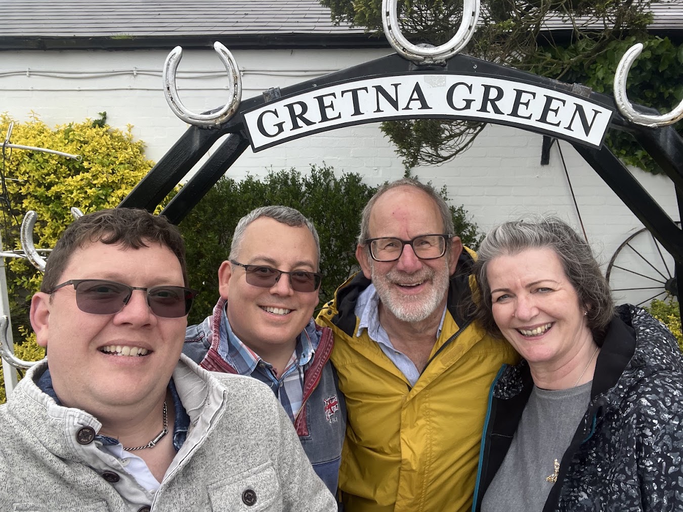
Situated immediately beyond the English border, Gretna Green has welcomed travellers arriving in Scotland for centuries.

For us, it offered a comfortable overnight stop before continuing north. It also gave us an opportunity to explore a village with one of the most romantic—and rebellious—histories in Britain.

Gretna Green became famous following the introduction of the Marriage Act 1754 in England and Wales. The legislation imposed stricter requirements upon marriages, including parental consent for people under the age of 21.

The Act did not apply in Scotland, where couples could marry at a younger age and without the same formalities. Gretna Green was conveniently located just across the border, making it a natural destination for young couples escaping disapproving families.

Marriage over the anvil

The village’s Old Blacksmith’s Shop became particularly associated with these runaway weddings.

Under Scottish law, marriages could historically be conducted by declaration before witnesses. Local blacksmiths became known as “anvil priests”, joining couples together in the same way that they joined pieces of metal.

The anvil consequently became an enduring symbol of marriage at Gretna Green.

It is wonderfully dramatic to imagine couples racing north by carriage, pursued by angry parents and determined to reach Scotland before being caught. The reality may not always have been quite so theatrical, but the stories gave Gretna Green a lasting reputation as the home of romantic rebellion.

Weddings continue to take place there today, preserving a tradition extending back for generations.

An evening with friends

After checking into our accommodation, we had time to wander around the village and absorb some of its history.

This was not intended to be a demanding sightseeing day. After the long drive, a leisurely evening was exactly what we needed.

Dinner with Neil and Naomi provided the perfect conclusion to the first day. We could relax, enjoy each other’s company and look forward to everything awaiting us farther north.

The holiday had begun with roads rather than waterways, but our conversation was already firmly focused upon boats, locks and the Scottish scenery ahead.

Towards the Caledonian Canal

The following morning, we would continue north towards the Caledonian Canal.

Stretching for approximately 60 miles between Corpach, near Fort William, and Inverness, the canal links a series of natural lochs through the Great Glen. Its route includes Loch Lochy, Loch Oich and the immense Loch Ness, surrounded by some of Scotland’s most spectacular scenery.

Unlike the more sheltered waterways we knew, the Caledonian Canal promised vast stretches of open water, mountains rising around us and an entirely different boating experience.

For several days, our hire boat would become both our transport and our home as we explored one of Britain’s greatest waterways.

The adventure begins

Gretna Green may only have been the first stop on our journey, but it marked the moment when the holiday truly began.

We had crossed into Scotland, shared our first evening together and reached the starting point of an adventure that would take us deep into the Highlands.

There were still many miles to travel before we stepped aboard our boat, but the excitement was already building.

Tomorrow, we would continue north—and the Caledonian Canal would be waiting.

Posted on

Returning to the Scene of the Crime: Tilly Mint Remains in Newbury

Six days after we nearly sank Tilly Mint while attempting to moor in Newbury, Chris and I returned to check on the boat—and decide whether it was safe to move her.

Our plan appeared straightforward: inspect the water levels and, if conditions had improved sufficiently, carefully take Tilly Mint back downstream.

Unfortunately, the Kennet & Avon Canal had other ideas.

Back to Newbury

The memory of our previous visit remained painfully fresh.

Strong flows had caught Tilly Mint as we attempted to moor, forcing her sideways and wedging her across the navigation. For 15 frightening minutes, we had struggled to regain control before five members of the public helped us bring her safely alongside the bank.

Leaving the boat in Newbury had been the only sensible option. Nevertheless, we remained concerned about her and hoped that a week of calmer conditions might allow us to move her somewhere safer.

As we travelled back to Newbury, we were cautiously optimistic.

That optimism did not last long.

The flooding had worsened

Rather than subsiding, the floodwaters had continued to rise.

The railway was disrupted by flooding, while replacement buses offered little assistance because several local roads were also affected. Simply reaching Newbury became considerably more difficult than expected.

It felt as though the entire transport network was delivering the same unmistakable message:

Do not move the boat.

When we finally reached the canal, the conditions confirmed it. Water levels remained dangerously high, the flow was powerful and the familiar waterway looked increasingly unpredictable.

Any hope of a gentle cruise back downstream quickly disappeared.

Assessing Tilly Mint

Our first priority was checking that Tilly Mint remained safe.

After the drama of the previous weekend, it was an enormous relief to find her still securely moored. We inspected the ropes, checked the boat and considered whether there was any safe way to move her.

There was not.

Attempting to set off would mean releasing Tilly Mint back into the same powerful flow that had overwhelmed us only days earlier—except conditions were now even worse.

Moving downstream might sound easier than travelling against the current, but strong water can carry a narrowboat far more quickly than expected. Bridges, bends, locks, weirs and moored boats leave very little margin for error once control is lost.

We had already received one warning. Ignoring the second would have been reckless.

The hardest decision was to do nothing

We had returned prepared to move the boat, but the responsible decision was to leave her exactly where she was.

It was disappointing. We wanted to take Tilly Mint somewhere safer and had hoped to spend the weekend aboard. After all the effort involved in reaching Newbury, turning around without cruising felt frustrating.

However, boating safely sometimes means accepting that the conditions—not the crew—will determine the plan.

No journey was worth risking the boat, ourselves or anyone who might once again have to come to our assistance.

We checked that Tilly Mint was as secure as possible, stepped back onto the towpath and left her to wait out the floods.

A lesson in patience

Canal boating is usually associated with freedom: releasing the ropes, choosing a direction and travelling at your own pace.

This experience reminded us that the waterways always retain the final say.

After prolonged rainfall, water levels and flows can change quickly. A stretch that normally appears calm can become hazardous, and confidence gained in ordinary conditions may offer little protection when nature behaves differently.

Knowing how to handle a boat is important. Knowing when not to move it can be even more important.

Waiting for calmer water

Our return to Newbury was not the adventure we had hoped for.

There was no cruise, no peaceful evening aboard and no satisfying moment when we finally carried Tilly Mint away from the scene of our narrow escape.

Instead, there was a careful inspection, a difficult decision and a journey home.

Yet doing nothing was unquestionably the right choice.

Tilly Mint would remain in Newbury until the floods subsided and the Kennet & Avon Canal became safe enough to navigate again. Our next adventure would simply have to wait.

Sometimes the most successful boating trip is the one during which the boat does not move at all.

Posted on

We Nearly Sank Tilly Mint: A Narrow Escape in Newbury

Our journey aboard Neil and Naomi’s narrowboat, Tilly Mint, from Hungerford to Newbury should have been a peaceful cruise along the Kennet & Avon Canal.

Instead, persistent rain, unusually strong flows and one frightening attempt to moor turned it into the closest we had ever come to losing control of the boat—and possibly sinking her.

Leaving Hungerford in difficult conditions

The weather had been poor, with recent heavy rainfall raising water levels and strengthening the flow along the canalised sections of the route.

We knew conditions were more challenging than usual, but the journey began without incident. Despite the drizzle, the Kennet & Avon remained beautiful: green countryside, trees leaning over the water and the familiar rhythm of locks carrying us towards Newbury.

The stronger flow demanded more concentration at bridges, bends and lock approaches, but we continued making steady progress.

As the day drew to a close, we began looking forward to securing Tilly Mint and settling down for the evening. We thought the most demanding part of the journey was behind us.

We were wrong.

The current takes control

As we attempted to moor in Newbury, the current caught Tilly Mint before we could bring her safely alongside the bank.

Within moments, the boat was being pushed sideways across the navigation. One end became trapped against the bank while the other was forced towards a moored boat on the opposite side.

We were wedged across the canal.

Normally, a narrowboat responds slowly but predictably. This time, the force of the moving water was greater than the control available from the engine and tiller. Every attempt to correct the boat’s position seemed to make another part of the situation worse.

The canal was no longer the calm, sheltered waterway we knew. It had taken control of the boat—and us.

Fifteen frightening minutes

For approximately 15 minutes, we struggled to free Tilly Mint.

The current continued pressing against the side of the hull, pinning the boat more firmly in place. The engine could provide power, but there was little room to manoeuvre and no safe angle from which to escape.

As the boat remained trapped awkwardly across the flow, the situation became genuinely frightening. A narrowboat caught against a strong current can begin to list, allowing water to reach openings that would ordinarily remain safely above the surface.

We became increasingly concerned that water might enter the boat. What had begun as a difficult mooring attempt now carried the very real possibility of serious damage—or worse.

Help arrives from the towpath

Thankfully, people nearby quickly recognised that we were in trouble.

Five members of the public came to help, taking hold of ropes and adding the strength we desperately needed from the bank. Their assistance gave us something the engine alone could not: the ability to control the boat from several directions at once.

Working together, we gradually changed Tilly Mint’s angle against the current. It was not a quick or graceful manoeuvre, but centimetre by centimetre the boat began to move.

Eventually, she came free.

With the helpers controlling the ropes from the towpath and those aboard managing the engine and tiller, we finally brought Tilly Mint safely alongside the bank.

The ropes were secured, the engine was stopped and, for the first time in what felt considerably longer than 15 minutes, we could breathe properly.

The kindness of strangers

Our overwhelming feeling was relief—but also gratitude.

The five people who stopped to help had no obligation to become involved. They saw a boat and its crew in difficulty and responded immediately.

Without them, freeing Tilly Mint against the force of the water would have been considerably harder and the outcome could have been very different.

Their kindness transformed a frightening situation into a powerful reminder of the community surrounding Britain’s waterways. When something goes wrong, assistance often comes from people who were strangers only moments earlier.

Respecting the water

The experience changed how we thought about boating in poor conditions.

Canals can appear gentle and predictable, particularly during calm weather. However, many sections interact with rivers, weirs, sluices and changing water levels. After prolonged rainfall, familiar stretches can behave very differently.

A heavy narrowboat may feel reassuringly solid, but it remains vulnerable when caught broadside by moving water. Once the flow takes control, the weight and momentum of the boat can make recovery extremely difficult.

Conditions must always be treated with respect, particularly when approaching locks, bridges, bends and moorings where space is limited.

Lessons from a narrow escape

Once Tilly Mint was safely secured, we could begin reflecting upon what had happened.

The experience reinforced several important lessons:

  • Check water conditions and warnings before setting out.
  • Allow considerably more room and time when manoeuvring in a strong flow.
  • Prepare ropes early and agree clearly who will do what.
  • Avoid becoming trapped broadside to moving water.
  • Never hesitate to accept—or call for—help.
  • If conditions feel unsafe, stopping early is better than pressing ahead.

Most importantly, never underestimate the power of water simply because it happens to be flowing through a canal.

An adventure we will never forget

Our cruise from Hungerford to Newbury became one of the most dramatic journeys we had experienced aboard Tilly Mint.

There was no triumphant arrival or elegant mooring—just an exhausted crew, a securely tied boat and enormous relief that everyone was safe.

It may become a story we can laugh about with the benefit of hindsight, but we will never forget the fear of being pinned across the canal or the sight of strangers rushing forward to help us.

Canal boating brings freedom, tranquillity and wonderful adventures. Occasionally, it also provides a sharp reminder that the waterways deserve our complete respect.

That day, teamwork and the kindness of five strangers prevented our narrow escape from becoming something much more serious.

Posted on

From Hungerford to Crofton aboard Tilly Mint

Two days after exploring the remarkable Crofton Beam Engines, we returned to the Kennet & Avon Canal aboard Tilly Mint to enjoy the journey through the landscape that those engines have helped sustain for more than two centuries.

Beginning in Hungerford, our route carried us through the peaceful countryside of the North Wessex Downs towards Crofton—a journey combining narrowboat life, beautiful scenery and some extraordinary waterways heritage.

Beginning in Hungerford

Our day began in the historic market town of Hungerford.

Known for its antiques shops and ancient Hocktide traditions, the town is surrounded by some of southern England’s most attractive countryside. The Kennet & Avon Canal passes quietly through it, offering a particularly inviting starting point for a journey by boat.

Once aboard Tilly Mint, we prepared to cast off and leave the town behind. Ropes were released, the engine settled into its familiar rhythm and we returned to the wonderfully unhurried pace of canal travel.

Into the North Wessex Downs

Beyond Hungerford, the canal enters a tranquil rural landscape within the North Wessex Downs.

Trees and hedgerows lined the water while open fields stretched towards the surrounding hills. Sheep grazed beyond the towpath, birds moved between the branches and the occasional waterside cottage appeared through the greenery.

From the stern of Tilly Mint, the landscape unfolded gradually. There was time to notice reflections moving across the water, listen to birdsong and enjoy the small details that would be missed when travelling by road.

The gentle sound of the boat moving through the water provided the soundtrack to our journey.

Life at narrowboat pace

A day aboard Tilly Mint was never simply about reaching our destination.

Canal travel creates its own rhythm. Locks and bridges divide the journey into a succession of small tasks, while stretches of open water provide time to relax, talk and enjoy the surroundings.

There is always something requiring attention: the position of the boat, an approaching bridge, activity at the next lock or wildlife deciding that the centre of the canal is the only reasonable place to be.

Yet none of it feels hurried. Progress is measured in miles rather than minutes, and the journey becomes every bit as important as the destination.

Approaching Crofton

As we continued towards Crofton, the engineering behind the canal became increasingly apparent.

The Kennet & Avon must climb to its summit before descending again towards Wiltshire and the Avon Valley. Maintaining sufficient water at this highest section was one of the greatest challenges faced by the canal’s original engineers.

Every boat passing through a lock carries water downhill. Without a reliable means of replacing it, the summit pound would gradually become unnavigable.

The solution was Crofton Pumping Station, built between 1807 and 1809 to raise water from the springs and reservoir below into the canal above.

Seeing Crofton from the water

Approaching Crofton aboard Tilly Mint gave us a different perspective from our earlier visit on foot.

The tall chimney and historic engine house rise beside the canal, immediately distinguishing the site from the surrounding countryside. It is an impressive reminder that even the most peaceful waterways depend upon substantial infrastructure.

Inside the Grade I-listed pumping station are two working steam-powered beam engines dating from 1812 and 1846. The older Boulton & Watt engine is celebrated as the world’s oldest working beam engine remaining in its original location and capable of performing its original purpose.

On selected steaming days, the engines still lift water into the summit pound—living machinery continuing the work for which it was created more than two centuries ago. Crofton Beam Engines

Engineering brought to life

Having recently explored the engine house, we could now connect the machinery inside with the waterway outside.

The great beams, pistons and pumps were no longer isolated museum exhibits. They formed part of the landscape through which Tilly Mint was travelling and helped explain how boats could continue navigating this elevated section of canal.

That connection made Crofton particularly memorable. The engines are magnificent examples of Industrial Revolution engineering, but their real significance becomes clearest when viewed alongside the canal they were built to serve.

Watching the water beside our boat, it was remarkable to consider the effort required to maintain something that appeared so calm and natural.

A pause beside the canal

Crofton provided an ideal place to pause and enjoy the surroundings.

The grounds overlook the canal and nearby railway, with the Wiltshire countryside extending beyond. It is a landscape shaped by several generations of transport history: canal boats moving at walking pace, trains passing nearby and historic steam engines standing between them.

After exploring, there was time to relax and reflect on the journey before returning to Tilly Mint.

A picnic beside the canal is one of boating’s simplest pleasures. Food somehow tastes better after a morning on the water, particularly when accompanied by attractive views and nowhere urgent to be.

Heritage that remains alive

The Kennet & Avon Canal has survived because generations of volunteers and campaigners refused to allow it to disappear.

The same spirit is evident at Crofton, where volunteers maintain the buildings, boilers and engines, operate the machinery and share its history with visitors.

Without their skill and commitment, the pumping station might have become a static monument—or been lost entirely. Instead, it remains connected to the working canal and continues to demonstrate the ingenuity of its original designers.

The Canal & River Trust describes the 1812 and 1846 engines as being among the world’s oldest working steam beam engines. Seeing their setting from the canal reinforced just how exceptional their survival is.

A journey through two landscapes

Our cruise from Hungerford to Crofton brought together two contrasting elements of the inland waterways.

There was the natural beauty of the North Wessex Downs: green fields, mature trees, wildlife and tranquil water. Alongside it stood the engineered landscape of locks, reservoirs, channels and pumping machinery that makes navigation possible.

Neither exists independently of the other. The apparent tranquillity of the canal is sustained by centuries of engineering, continual maintenance and the efforts of those who care for it today.

Travelling aboard Tilly Mint allowed us to experience both.

More than a destination

Crofton Beam Engines may have been our destination, but the journey from Hungerford was an essential part of the experience.

At narrowboat pace, we watched the landscape change, worked through the canal’s structures and gained a deeper appreciation of the infrastructure supporting the water beneath us.

It was another memorable day aboard Tilly Mint—and a wonderful reminder that Britain’s canals are not merely routes through the countryside. They are living pieces of history, best understood by travelling slowly through them.

Posted on

Bowling Basin: Where the Canal Meets the Clyde

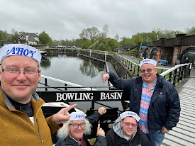
At the western end of the Forth & Clyde Canal lies Bowling Basin, where the sheltered inland waterway meets the broad tidal waters of the River Clyde.

Once a busy industrial harbour, the basin has been transformed into an attractive destination for walkers, cyclists and visitors. Its railway heritage, regenerated arches and expansive views make it a fascinating place to explore—but we could not help feeling that it deserves to welcome many more visitors by water.

Reaching the western end of the canal

After our Scottish waterways holiday, we visited Bowling Basin to see where the Forth & Clyde Canal completes its journey west.

The canal stretches across central Scotland, linking the Clyde with the Forth and creating a navigable route between the country’s east and west coasts. Bowling therefore feels like more than simply another canal basin: it is the threshold between inland cruising and considerably more adventurous tidal waters.

Standing beside the basin, we could look beyond the protective sea lock towards the Clyde and enjoy those wonderful views “doon the watter”.

A harbour shaped by industry

Bowling Basin was once a thriving centre of trade, boatbuilding and industry.

Canal boats brought goods westwards to meet vessels using the Clyde, while the surrounding railways connected the harbour with Scotland’s expanding industrial network. The surviving railway arches, disused tracks and swing bridge all provide reminders of the basin’s working past.

Although the commercial traffic has largely disappeared, its history remains clearly visible. This is not a heritage site preserved behind barriers; it is a landscape that has been adapted and given a new purpose.

A railway transformed

One of Bowling Basin’s most distinctive features is its former railway infrastructure.

The abandoned tracks and striking swing railway bridge have been incorporated into a linear park, allowing visitors to walk through parts of the site that were once dominated by industry. The old railway arches have also been restored and repurposed for small businesses and visitor facilities.

The result is an atmospheric mixture of canal, harbour and railway heritage. Rusting metalwork and old stone structures sit alongside improved paths, landscaped areas and modern activity.

It is regeneration that respects the site’s character rather than attempting to erase it.

Views “doon the watter”

The views from Bowling are tremendous.

Looking west, the Clyde opens towards Dumbarton and the distant hills, creating a dramatic contrast with the narrow, sheltered canal behind. The broad water and changing light give the basin an atmosphere unlike anywhere else along the Forth & Clyde Canal.

It feels simultaneously like the end of one journey and the beginning of another.

For generations of Glaswegians, travelling “doon the watter” meant heading along the Clyde towards the coastal resorts and holiday towns beyond. Standing at Bowling, it was easy to understand the enduring pull of that journey.

A destination deserving more boats

The regeneration work has helped establish Bowling Basin as a popular destination for walkers, cyclists and day visitors.

However, we would love to see more people arriving in the way that feels most appropriate: by boat.

More visiting boats would bring additional life and activity to the basin while strengthening its connection with the wider canal network. It could become a natural destination for boaters travelling west along the Forth & Clyde Canal, rather than simply somewhere to reach, turn around and leave.

With its history, views and restored surroundings, Bowling has all the ingredients needed to become one of Scotland’s most memorable waterways destinations.

Where canal, river and history meet

Our visit to Bowling Basin offered a fitting conclusion to our exploration of the Forth & Clyde Canal.

From the Falkirk Wheel and the journey into Glasgow to the open views across the Clyde, the canal had revealed engineering, industrial heritage and extraordinary contrasts throughout its length.

Bowling brings all those elements together. It is a canal terminus, a former industrial harbour, a regenerated public space and a gateway to the Clyde.

Most importantly, it is a place with enormous potential—both as a destination on land and as somewhere that could once again come alive with boats.